The new maps show the two UTs clearly demarcated, and while Pakistan-Occupied Kashmir’s Muzaffarabad and Mirpur areas have been kept as part of the UT of Jammu and Kashmir, Kargil and Gilgit and Baltistan have been shown as part of Ladakh UT.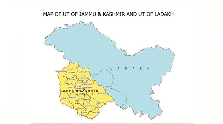 (Source: MHA)
Following the official bifurcation of the erstwhile state of Jammu and Kashmir into the two Union Territories (UT) of Jammu and Kashmir and Ladakh, the Survey of India has come out with new maps of India and the Jammu and Kashmir region.
The new maps show the two UTs clearly demarcated, and while Pakistan-Occupied Kashmir’s Muzaffarabad and Mirpur areas have been kept as part of the UT of Jammu and Kashmir, Kargil and Gilgit and Baltistan have been shown as part of Ladakh UT.
The President, too, issued an order on Saturday identifying Leh, Kargil, Gilgit, Gilgit Wazarat, Chilhas and Tribal Territory of 1947 as part of the Ladakh UT.
“The Leh district of the new Union Territory of Ladakh has been defined in the Jammu and Kashmir Reorganization (Removal of Difficulties) Second Order, 2019, issued by the President of India, to include the areas of the districts of Gilgit, Gilgit Wazarat, Chilhas and Tribal Territory of 1947, in addition to the remaining areas of Leh and Ladakh districts of 1947, after carving out the Kargil District,” a statement from the Ministry of Home Affairs said.